DBNet
The Direct Broadcast Network ( DBNet) is a set of operational arrangements for the real-time acquisition of Low Earth Orbit (LEO) satellite data through a worldwide network of local, Direct Broadcast receiving stations and the rapid delivery of these data to the global user community after pre-processing and formatting in accordance with agreed standards.
Motivation
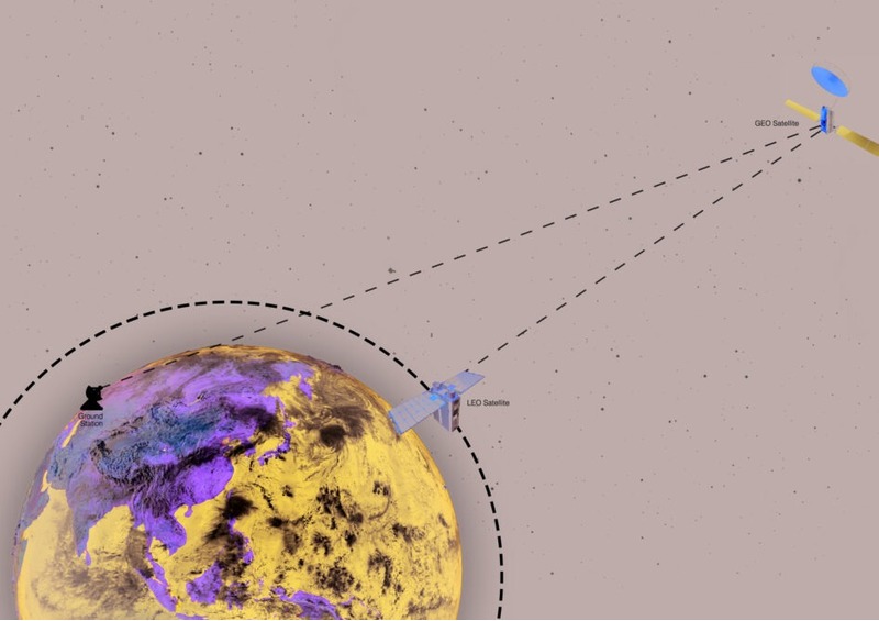
Sounder data from LEO satellites (in particular from the ATOVS suite of instruments) are among the most important sources of observation used by Numerical Weather Prediction (NWP) models. A brief description of the benefits they bring can be found in ATOVS-impact-on-assimilation-JMA-2007. Like all NWP model inputs, their assimilation is constrained by their time of availability. While locally received data (via Direct Readout reception systems) can be available in a timely fashion for the NWP models, the availability of global data is delayed by the storage time on-board the spacecraft and the procedures involved for the data collection, processing and distribution. The DBNET concept enables the delivery of LEO data, in particular sounder data, collected from a regional network of HRPT stations within the timeliness constraints imposed by NWP models.
However, not all WMO regions are well-served by HRPT data collection networks and so the main objective of DBNet is to facilitate the introduction of such regional networks, together with appropriate regional dissemination mechanisms, and inter-regional data exchange facilities, across the globe.
Background
DBNet has its roots in the EUMETSAT ATOVS Re-transmission Service (EARS). EARS was initially established in 2002 in response to the requirements of Limited Area NWP modelling over Europe (HIRLAM then ALADIN) whose modelling area exceeded the coverage of a single HRPT station, and whose timeliness constraints were not compatible with the current scheme of global data collection. By merging the data sets from several HRPT stations EARS enabled the extended coverage and short timeliness requirements of the NWP operators to be met.
In recognition of the very positive impact that EARS data made to NWP model performance, the Co-ordination Group for Meteorological Satellites (CGMS), at its thirty-second session in May 2004, asked whether the system could be expanded into other Northern Hemisphere regions, and then extended to cover the Southern Hemisphere.
With this aim in mind the CGMS encouraged the WMO Space Programme to contact CGMS members and potential regional participants with a view to forming local consortia to develop Regional ATOVS Retransmission Services similar to EARS. In response to the WMO Space Programme in 2004 started the RARS project.
After the launch of the Suomi-NPP and FY-3 satellites with new suites of instruments, it was recognized that the scope of the RARS project needed to be extended and in 2015 the RARS partners agreed to rebranding the initiative as the “Direct Broadcast Network for Near Real-Time Relay of Low Earth Orbit Satellite Data" (DBNet)
An important consideration in the establishment of regional collection networks is the capability to deliver homogeneous sets of data from different sources to NWP Centres so that they can merge them with confidence. Hence DBNet also places considerable emphasis on the standards that DBNet Operators should adhere to, in order to guarantee the global consistency of the various DBNet data sets.
Benefits
It is a widely quoted fact that observations from satellites impact the performance of NWP models to an extent that exceeds the sum of all other observation types. Of the various types of satellite observations that are available it is the data that describe the temperature and humidity of the atmospheric column beneath the satellite, including those data from the well-established ATOVS instrument suite, that result in the greatest benefit. The advent of sophisticated so-called variational data analysis methods in recent years has enabled the full significance of these vast data sets to be realised. They play a particularly important role by virtue of their global coverage and consequently NWP model performance over otherwise data sparse areas (such as oceans) is markedly improved.
Typically, NWP operators run their numerical models over a range of different domains, with the different variants having different spatial resolutions. For example, an NWP centre in Europe may run the forecast model for an area covering their local (national) region at the highest resolution, a version covering a continental domain at a slightly coarser resolution and also a version covering the whole globe at a somewhat lower resolution. The choice of resolution is governed by several factors including the ability of the model to represent the complex atmospheric processes at the chosen resolution, the availability of observational data at the model resolution and the available computer power. Generally, the higher resolution and smaller domain versions of the models are run with a deadline time for input observations much shorter than that for the global model. These arguments feed into the motivation and background for the DBNet initiative.
DBNet system concept
Compared with the normal means of access to global data, this approach allows access by users to a regional sub-set of data without the delay associated with on-board data storage prior to a full orbit data dump to a Command and Data Acquisition station.
The way in which the global DBNet network is built from individual regional networks with using the GTS for inter-regional exchange is shown in this diagram.
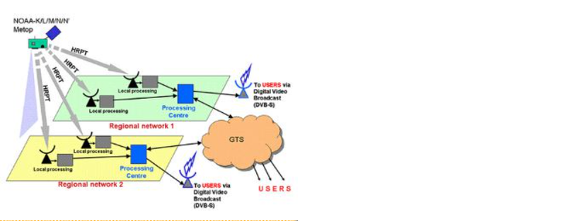
Image Upload
Add image